Crime Mapping And Prediction
User friendly GIS applications has allowed crime mapping and analysis to flourish within law enforcement agencies. Software, training and resources are easily available to those interest in this use of GIS. Experts says "If you have a crime analysis unit and you are not using GIS Technology, you are missing a key component.”
Applying GIS Technology to Crime Analysis:
GIS aids crime Analysis by -
Identifying and highlighting suspicious investigations and events that may require further investigations.
Enhancing the implementation of various policing methodologies to reduce over all crime and disorder.
Providing tools and techniques to capture crime series and forecast future crime occurrences.
Whether the problem is tactical, strategic or administrative any data containing location information can be displayed and analysed using Geographic Information System(GIS) technology.
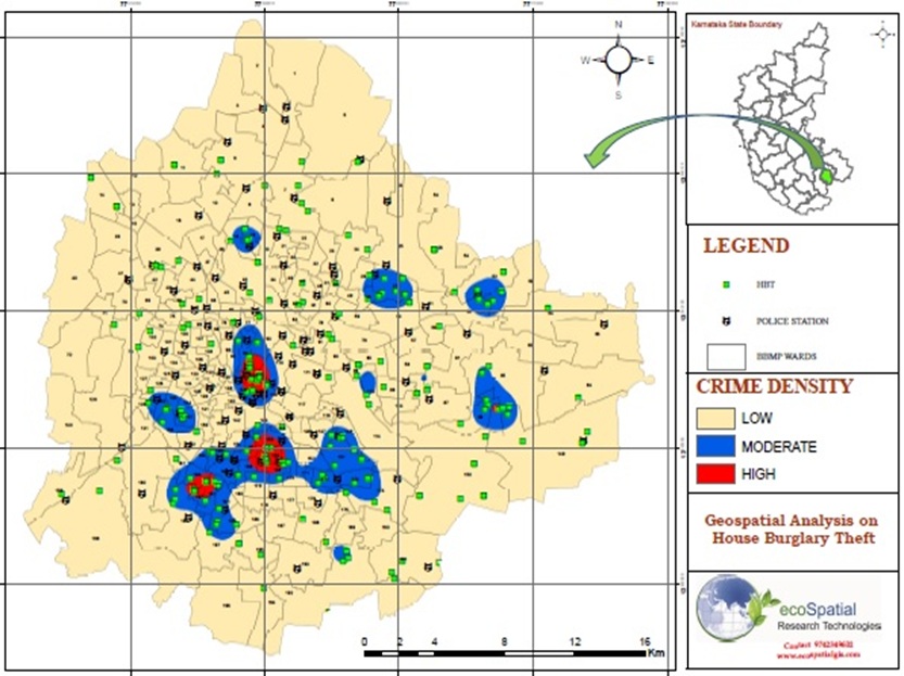
Every crime problem is related to some location, whether it’s an address, street, PIN Code or district. GIS can help you leverage the location aspect of your data to analyze, understand and build solutions to the problems you face.
Geoprofiling
Get introduced to this intelligent method of locating serial criminals using geography.
Strategic Crime Mapping:
Using GIS to improve community safety
GIS identifies areas that contain dense cluster of events(hotspots). The high concentration areas usually demand special attention.
